Friday, 28 February 2014

Feb 25th: Etna

Etna is the most active volcano in Europe. It is in a constant state of change so is difficult to predict. In 1971 the early warning station set up to give advanced notice was caught out and destroyed by an eruption. Most recently there have been ash showers as shown from the drift at the side of the road. These are common enough for there to be permanent notices warning cyclists and motorcyclists of the risk of skidding.


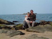
I hasten to add that Jane is wearing a money pouch (21st century equivalent of the sporran), not a red leather bikini over her trousers: it’s not that sort of holiday.

We are driving up Etna’s northern slope where the road reaches 6,000 feet plus before descending, 20 miles farther on. The mountain peak is much higher at 10,900 feet and the upper slopes are attainable by cable car from the southern side. Since 1979 tourists can’t ascend the final 1,000 feet to the top because it’s too dangerous: 9 tourists were killed that year on the main crater lip. We’re not doing the cable car run as it’s too cold in winter and the lofty parts are mostly covered by clouds. They were today, so we made the right choice.

The road width and surfaces are good in spite of the seismic challenges, and we climb steadily until the route cuts through a huge lava field. This was the last major eruption, in 2002. The lava runs for many miles and the volume of out-pouring is vast. Here are a few photos that don’t really do it justice.


The dots on the skyline are actually people, so gives some idea of scale. We carry on driving up to the top and what happens to be the snow line. It seems, by the inactive ski lift and the bare snow poles on either side of the road, that maybe they haven’t had much snow this year. Anyway, there’s enough for a snap of me on an old grubby patch of it. I’m trying not to look like an old grubby poser.


There’s a lot more snow higher up, visible intermittently between the swirling clouds. It looks quite dramatic over the top of the lava flow, a bit like pictures of the Earth seen from space.


The whole of the lower slopes below the snow line are densely wooded, apart from what the lava has claimed. Below about 3,000 feet there are also many villages, some of which have suffered severe damage from eruptions. I wonder why people would want to live in such a dangerous area. Maybe to get the benefit of free underfloor heating!

Etna has more to offer: walking trails, visits to craters, gorges, and wildlife, but winter is not the best time for ordinary tourists like ourselves to be exploring high mountains. It was, nevertheless, an absorbing peek into a very different environment. A far cry from the Guy Fawkes firework called Mount Etna shaped like a cone that roared up a column of sparks for a minute or so to parody an eruption.  


Wednesday, 26 February 2014

We Do Like to be Beside the Seaside

The campsites open in Sicily in wintertime are all near the coast and, as they’re not too busy, we’ve been fortunate enough sometimes to get a sea view. Lucky again this time, as we are overlooking the beach.

 
The view to the right from the caravan window is the best: sandy beach and headland with old watchtower, and then hilltop village just out of camera. But- and this is an important but- you’ve got to make a mental adjustment before looking at the photo, because it’s BLACK sand and rocks. It’s all volcanic in this area so the first impression is that we are in Nutty-Slack-On-Sea. For those readers from a different era, who didn’t experience coal fires and coal deliveries, nutty slack was a type of poor quality coal consisting of dust and small lumps.

The helpful campsite manager suggested the village on the hill would be worth a visit. So up we went, to Forza d’Agro. A good road zig-zagged to the elegant central square, where we parked. Easy at this time of year but it must be a nightmare in season.


All the best old villages in Sicily have a ruined Norman castle and here is the view as we look back from the steps up to Forza’s castle. It’s locked, but never mind, it’s ruined anyway. You can see what a good defensive position the village has, perched on its rock pinnacle 1400 feet above the sea.


The village is a maze of steep, tight streets. These are generally just about accessible with a small car or scooter. I think the car in the next photo might be a bit optimistic if it’s going to negotiate the steps as well as the narrow alley.


The views are exceptional from anywhere on the edge of the village. Our campsite is visible, as is the mainland if it’s not too misty, and far into the mountains which is the panorama in the next photo.


With the extensive and varied terrain of Sicily, it doesn’t feel like an island. It’s actually 25% bigger than Wales, and is the largest island in the Med. I’m starting to sound like the Sicilian Tourist Board, so let’s go back down the hill to the caravan for a cup of tea.


Sunday, 23 February 2014

SferraCavallo

This is where we stayed, a coastal town, really a suburb of Palermo. Being that close to the metropolis it was more closed in, but we had a good size pitch with a view of the mountain crags. Evening shadows, unfortunately, but the neighbours opposite seemed to have washing out most days, so not good for tasteful photos.

 
The seaside in town amounted to a small fishing harbour and volcanic rocks along the coastline. A pavement and then a pathway followed the coast for a good few miles making a pleasant evening walk.


Strolling back towards the town at dusk, heading west that is, gave us some golden sunsets. This next photo is interesting because, in the clear evening air, the long headland of the Zingaro Reserve is silhouetted about 40 miles away. That’s where we were at our previous destination.


But now, on Wednesday 19th Feb, it’s goodbye to Palermo. We’re going to Sant Alessio Siculo on the east coast, under Mt. Etna’s shadow.


Friday, 21 February 2014

Feb 17th: Monreale

Monreale is the name of both the town and the cathedral, located on a hill 5 miles from Palermo, but a world away from the chaos of the big city. It’s an oasis of tranquillity. The police were even moving unauthorised car parkers, an impossible and unattempted task in Palermo itself.
The views over Palermo are extensive, this one taken from a street near the cathedral.
The cathedral was built in the 12th century by William ii of Normandy. It has Arab and Greek features, so doesn’t look quite like the standard UK Norman cathedral. We don’t have those tall palm trees either.
But it’s the interior of the cathedral that is unique: it is the best collection of mosaics in the world, all 6,400 square metres of it (69,000 square feet). They used 2.2 tonnes of gold. Let’s step inside.
Initially your eye is drawn to the golden glow of the altar end. Walking towards it reveals that the whole of the church walls are covered in mosaic scenes from the Bible, and the floor is in intricate mosaic patterns.
Using the camera zoom for a closer view of the Christ figure above the altar, the richness of the image and the quality is outstanding.
Jesus and the Saints claim the altar end, with the rest of the church containing about 130 mosaic scenes from the Old and New Testaments. This is an example. It must be Adam and Eve in the upper illustration- I’d recognise those fig leaves anywhere.
Example no2 is of Noah & helpers sending the animals out of the ark at the end of the flood. Light from the windows is unfortunately causing the glow on the top.
There were later additions to the cathedral in the form of a baroque chapel, more ornate than anything we’d previously seen anywhere and quite overpowering. I wouldn’t fancy the living room done out like this.
Again, it’s the detail that’s most impressive; the next photo shows a curtain carved out of marble- how is it possible to chisel these swirls without breaking the marble?
We could have spent longer in the cathedral and there were areas we didn’t visit, but it closed for lunch at 12.30pm (until 3.30pm). However, it was maybe for the best because you can only take in so much when surrounded by this amount of magnificence. We’ll have to return some other time.  Jaw dropping stuff!


Tuesday, 18 February 2014

Valentine’s Day in Palermo

Palermo is the 5th largest city in Italy, and is busy and congested. We caught the local bus from near the campsite into the centre, a distance of about 10 miles, and that took an hour.
We started at the Quatro Conti, the crossroads that divides old Palermo into its four original districts. Right there is a small church, La Martorana, dating from 1143. It was built by the Greek chief minister of the Norman King Roger ii, so it is basically a Greek Orthodox Church, with world class mosaics by Byzantine craftsmen. It’s literally covered in mosaics, roof, floor and walls, as the next two photos show.


La Martorana is next door to an even smaller church, San Cataldo, a mixture of Arab and Norman design. It’s now been restored as a church, but was used as a post office in the 19th century. Photo: La Martorana left, San Cataldo right.


In the next square is a beautiful fountain surrounded by white marble statues. You can’t get near the fountain because it’s enclosed by iron railings. A shame, yes, but there is a good reason. It wasn’t originally enclosed, but the statues are all nudes and the railings are there to keep the graffiti artists at bay!


Just around the corner is another lovely church, Santa Caterina, of later date, this time in ornate baroque style (17th/18th century). Every inch is covered in elaborate marble sculptures and decoration, with beautiful inlaid floors. Take a look at just one side chapel.


There’s also a captivating 3D picture of Jonah and the whale. The whale, in the bottom left-hand corner, looks a friendly, cuddly sort. With his twinkly eye and open mouth he could be a muppet character about to break out into a jolly song.


Strolling around the centre we came upon a huge street market that dates back to the Arab era. It still retains that atmosphere, which took us back to Morocco. The photo seems much too orderly and can’t convey the hustle and bustle of it all.


On the other side of the market was a much poorer area where buildings were scruffy and the streets piled up with rubbish. Whilst we couldn’t say the people were in any way threatening, we didn’t feel comfortable so didn’t linger.    
We soon came to the 16th century Porta Nuova, one of the main gates into the old city. It commemorates King Charles V’s exploits in Tunisia, and is covered in carvings of stern turbaned figures, see sample underneath. The upper warrior seems to be holding the hair of the lower one who is grimacing as if to say, “if you keep on pulling my hair I’m gonna thump you.”


Just beyond the gate, and after a tasty hazel nut ice cream, the cathedral comes into view. A beautiful exterior, if you ignore the repair hoardings and scaffolding. In style, it’s a mixture of St Pauls in London and Kings Cross railway station. The interior’s somewhat bare and cold, so no pic included.


An interesting feature is the weather vane above the clock. It’s the figure of a bishop, and could well be a subtle comment on the church hierarchy being inclined to go whichever way the political winds are blowing at the time.
Palermo had much more in the way of churches, palaces and museums but there’s only so much you can do in a day. The overall impression was of a city with a wealth of multicultural roots. We had a very enjoyable visit.


Thursday, 13 February 2014

Zingaro Natural Reserve

The Reserve is on the other side of the mountains from the campsite, only a few miles as the crow flies or via a goat track over the tops. Regular access is around the mountains to the north or to south, and we did both on separate days.
The main route within the Reserve is a rocky footpath following the line of the coast that connects the north and south entrances. This is typically what the path looks like.


The coastline is rugged so it’s a picturesque route with scrub plants and a variety of wildlife. We didn’t see much wildlife apart from the occasional rapidly flitting bird, but Jane did spot these odd bristles on the path (largest one is about 6 inches long).


At the exit, the Reserve Warden (where was the regular one?)  said they were from a porcupine. The internet expanded on this to explain that it was a Crested Porcupine, the only European species of porcupine, and quite rare. They have been known to charge backwards, so maybe it was as well we didn’t blunder into it. 
A few trails from the coastal path head inland into the mountains, wild country as you can see from the photo.

The route goes past a big cave. A plaque nearby describes finds in the cave dating from 10,000 BC, the earliest known inhabitants of the island. The cavemen here had no excuse for not recording details of their history, having generous supplies of porcupine quills lying around.
 

To create a proper path at the southern end, a tunnel has been blasted through the rock. It shows how isolated this area must have been in the not too distant past, with just a few fishermen’s dwelling inside the Reserve only accessible by boat or very rough trails. It was rumoured that the area was a favourite dropping ground for Mafia smuggled drugs, and that the opening of the Reserve in 1981 included negotiations with the Mafia. I’m sure a suitable alternative was agreed.


Just outside the Reserve is an old, abandoned, tiny fishing village, La Tonnara di Scopello. It’s in an idyllic setting with a line of rock pinnacles outside the harbour entrance and a ruined watch tower on the cliffs. How romantic is that? Probably not very, after a hard night’s fishing- you’d swap it there and then for a bottle of Chianti.


There was a small church, the most important building in the village when you’re trying to ensure favourable fishing weather. A miniature, but beautiful in its simplicity.


And what was this sink used for, washing clothes, gutting fish? The triangular splash-back is so beautifully made in mosaic. The discoloured plaster and rusty anchor make up the collage; it looks like it’s grown, like a plant.


We’ve enjoyed the tranquillity of San Vito Lo Capo, and now for something different as we are upping stumps and off to the hustle and bustle of the island’s capital Palermo on Wednesday 12th Feb.


Tuesday, 11 February 2014

6th Feb: Erice

Erice is a medieval town on the west side of Sicily. My Rough Guide tells me it was founded by the Elymnians, whoever they were, when they settled in this part of Sicily, well before the Greeks appeared, in about 1200 BC. They originally called it Eryx, and I was disappointed not to find an Eryx Bar in the town. You know, as in Eric and Ernie.

Some of the early town walls from 800 BC are still standing, in remarkably good fettle; they’ll outlast the cars, that’s for sure.


The site was chosen for its fortress qualities. It’s on a table-top mountain 2,350 feet high. I should be reporting that the road up was a scary switchback, but it was really very good, twisty of course, but quite wide and well surfaced with barriers. I don’t think Jane had to shut her eyes once.

This is a view from the town looking down over the regional capital Trapani and the Egadi islands. On a clear day you can see Tunisia over 100 miles away. We didn't feel like waving anyway.


The position looks impregnable, but it was conquered in succession by all the invading powers of the day, the Romans, the Arabs, and the Normans. I was surprised to learn how much of Sicily the Normans ruled. This was a boom era for Erice, the Middle Ages, after which not a lot happened so it’s stayed in that time warp until present times. So we have a Norman Castle very much like those at home, looking down from a lofty crag on one edge of the town.


The Norman cathedral is also a familiar type, so instead of a photo of the building, I’ve put in a close-up of its unusual rose window. It’s a wonderfully intricate stone carving of a circle of what appears to be carpet beaters. The Normans may have been savage warriors and tyrannical overlords, but they clearly valued clean carpets!


The guide book says to just wander around the town, there’s no specific route. So we did, and this is a typical sort of alley. The whole town is paved in these medieval cobbles that we saw workmen painstakingly repairing so as to keep the traditional look.


There are 60 churches in Erice. This is just one that we came upon with a pretty bell tower.


I suppose Erice leaves two distinct impressions, firstly, the medieval feel of the place as it’s mostly all of that period and, secondly, the fantastic views in all directions. As well as the big vistas, looking over the edge sometimes shows a precarious church, or fairy-tale castle built on a pinnacle as in the next photo.


The ascent/ descent took us 20 minutes each way in the car for the 8 mile journey, so it doesn’t bear thinking about how arduous this must have been in ancient times. There’s even a cable car up from Trapani now, but closed during the winter.


Monday, 10 February 2014

Sat 1st Feb: to San Vito Lo Capo

We moved about 100 miles to the north-western side of the island. The site is large but quiet as it’s out of season and is also in the middle of nowhere, on the seashore with cliffs behind. It’s the cliffs that seem to generate the customers, i.e. lots of climbers. We have now got used to seeing them swinging from impossible angles on the cliff face.

 
There appear to be a number of pre-prepared routes that have bolts already hammered in. The climbers attach their clips to these bolts through which they feed their ropes so if they fall, they only drop as far as their last clip. Just hope those bolts are in tight.........  well of course they........
 
 
Being on the coast, you’d expect this place to be a swimmer’s paradise. Unfortunately not, as a plaque explains on the nature trail. The seashore fringe, or pavement as it is called, is made from a kind of shell material not unlike a coral reef. It’s between 20 and 50 metres wide most of the way around the big bay and is hard and sharp. You don’t walk here without stout shoes never mind swim. This is the general appearance of the seashore with me well camouflaged on the left. Stick with rock climbing, it’s safer!
 
 
The landscape is certainly beautiful as we are on the edge of the Zingaro Natural Reserve. It’s also part of the state-owned forest. This can’t be too difficult to administer as there don’t seem to be many trees on it. This is a view looking inland towards the Reserve.
 
 
At dusk, a chain of islands becomes visible silhouetted across the far side of the bay, to the right of the headland, looking like the humps on the Loch Ness monster. 

The nearest town is San Vito about 3 miles away. It’s small, pleasant enough with no special features (it does have a sandy beach!!), but as in many parts of western Sicily shows influences of Arab occupation just like southern Spain. This next photo is the church, followed by the flat-topped buildings of the main street; it reminded us of Morocco.