Tuesday, 22 June 2010
June 21st: The Suisse Normande
I suppose any comparison with Switzerland raises high hopes- impossibly high hopes. However, the scenery was impressive, with more rocky crags and steep valleys than in other parts of Normandy. The Suisse Normande area mainly follows the river Orne and the photo below gives a typical lovely view, with the Orne centrestage.
Strolling around in Clecy, near where the above photo was taken, we came across an unusual use for ex-WW2 ordnance- as electric fence supports (the rings welded on the side hold the wire). That’s me looking shell-shocked. The battle swung inland after D-Day and the whole of Normandy saw fierce fighting: it’s heartening to know that some expended armaments were put to good use!
It was good to see lots of outdoor recreational activities provided, particularly for youngsters. We saw several parties of young canoeists on the Orne, and these below were having great fun playing a kind of canoe basketball that seemed to exercise their skills at manoeuvring the craft as well as all getting soaked.
Saturday, 19 June 2010
June 19th: Alençon Lace
Alençon is a pleasant town with a long history associated with lace making. A typical street near the old town centre is shown above.
In contrast to most towns who go all out to capitalise on their past, there was no evidence visible of their former lace industry at all, nothing in the shops, no café/hotel/restaurant names associated with it etc. This was in complete contrast to Mère Poulard of Mont St Michel, a solitary figure from the past done to death by the trinket industry, and surely a missed opportunity for Alençon with a genuine heritage stretching back centuries.
But there was a local museum with a large lace section, and it was fascinating.
This example is about 4 inches across, and look at the incredible detail! Even the background mesh is created by the lacemaker and there are 9 stages in producing the finished product. It took an astounding approx 1,000 hours to make this 4-inch circle. We saw much bigger works of immense intricacy and skill, representing eras when all nobility, men and women, and high-ranking churchmen were generously adorned with lace. There were about a dozen other lace making centres in France, but Alençon was top rank. The industry started to shrink in the early 19th century and today survives in one small local sponsored workshop.
The museum also contained many works of art, a few with an unusual label alongside. See underneath, where the text of the notice is magnified.
What it says is:
PLACEMENT BY THE STATE
WORK RECOVERED
BY THE ALLIES IN 1945
A further panel elsewhere explains that when the French works of art pirated by the Nazis were reclaimed in 1945, there were some that could not be reunited with their original owners. The state then stepped in and allocated these works to an appropriate museum. So there's a lottery-style win waiting for some worthy relation who can prove his rights of inheritance, but presumably you're disqualified if you have a German name!
Thursday, 17 June 2010
June 15th Bagnoles
Bagnoles is a spa town, which have as common features: elegant (= expensive) shops, smart restaurants and well-groomed parks. Adjacent to the town centre is an ornamental lake that Jane is looking into trying to spot the large fish. All very pleasant, if unspectacular.
The chateau here is the council offices, set in a landscaped park with specimen trees and views over the town. It is noticeable how many doddery old folk there are both in the parks and in the town, which is to be expected as Bagnoles is a working spa town, and they are here for the cure. A curious side effect is that it’s difficult to park in town- there are loads of spaces, but they are practically all reserved for disabled badge holders.
This above is the sharp end: the treatment complex. The warehouse type building on the right is the spa hotel and the building backing onto the woods is the treatment centre. The treatment, the cure as they refer to it here, consists of bathing in or drinking the mineral water that is also slightly radioactive. The claims for its range of effectiveness unsurprisingly seem too good to be true. But you do see a lot of sprightly old folk around who, incidentally, also glow in the dark- so keep an open mind!
Monday, 14 June 2010
June 9th to 12th: Now Normandy
On Wednesday June 9th we drove from Dinan to Bagnoles de l’Orne in Normandy, a journey of just over 2 hours. The weather’s been changeable since we arrived, with heavy showers, but today was fine so we went to the nearby town of Domfront about 10 miles away. Bagnoles itself can wait ‘til we’ve explored it in better weather.
Domfront
This is a really pleasant fortified historic town, built on a hill. As expected, the old town is full of picture-postcard half-timbered buildings. It’s not always obvious which houses are the genuinely old ones and which are recent imitations, but one did have a date of 1515 carved on a lintel in the street running from the square in the photo.
Leading off the main street are many ancient courtyards into which you expect a party of knights on horseback to clatter at any moment. That is, if you ignore the satellite dishes and the lady wearing jeans.
The castle grounds are the town park and are delightful, with splendid views in all directions from its’ commanding position. The flowerbeds merit a special mention as they are composed of a mixture of red lettuce, blue/grey cabbage and pepper plants, as well as flowers. I hope the photo gives some idea of this strange but effective mixture.
A high, hedged fence runs alongside one steep elevation of the park, and halfway along it is the plaque shown below, referring to a nearby wartime safe house. It’s easy to think that, because France was quickly overpowered in the last war, all French people gave up and waited passively for the UK/USA to defeat Germany. Maybe some did, but there is ample testimony all over France to the huge risks that many inhabitants took to do their best to contribute to victory. (You might remember us describing the memorial near Brantôme to the 26 locals executed there.)
Ok, but where’s the house? It is actually behind the memorial, on the other side of the hedge, built against the precipitous rock wall. We couldn’t find it for ages, and only by leaning out over one of the battlements was the picture possible.
Now for some older history: we are in Normandy after all and we have here the ruins of a Norman castle. The only two walls standing are those of the keep, or donjon as they call them here (were the original builders Don and Jon, do you suppose, sort of like Ant & Dec?)
The castle was built in 1092 by Henry Beauclerk, one of William the Conqueror’s sons. He became Henry 1st of England in 1100, at which point Domfront became an English possession. It was also much frequented by his successor Henry 2nd and his queen Eleanor of Aquitaine with the royal court.
It was here in 1170 that a final attempt was made, unsuccessfully, to resolve the quarrel between Henry and his archbishop Thomas à Becket. He was murdered at Canterbury later in the same year.
Becket spent some years in exile in France previous to that and celebrated Christmas mass in 1166 in Notre Dame sur l’Eau, a church by the river in Domfront lower town. It still survives, much restored as a result of roadbuilding in 19th century and WW2. You really do feel in touch with the past in these old buildings, in this instance standing just where Becket stood.
Friday, 11 June 2010
June7th: Last Days at Dinan
There seems to be lovely scenery wherever you look in France. I know that’s because on holiday you’ve got the time and inclination to search it out. The abbey by the river was only a few miles from the campsite, an evening walk. The abbey fits in so well with the setting that it could have grown there with the trees.
Last day, and a picnic by the sea. That’s us, on a stunning headland overlooking several inlets and bays with islands. Lots of boats of all sizes and types were visible, from a canoe and sailing boats up to cargo ships heading for St Malo, and also a naval vessel, so plenty to look at through the binoculars. No picnic by the sea is complete without a seagull, and this one here had a great weakness for Pringles.
Thursday, 10 June 2010
June 5th: The Rance Estuary
We’ve already described the walk along the estuary into Dinan. There was no evidence of it being tidal, but walking the other way explains why: a barrage and lock gates. So, on one side of the lock is a marina permanently full of water, on the other a tidal river.
A road runs across the barrage so when a tall-masted yacht wants to go through the lock, the lockkeeper has to move the road out of the way. It swivels, as the photo shows. We were actually stood on the swivelling section before it moved, and couldn’t understand why the lockkeeper kept waving at us. “What a nice chap”, we thought, only reflecting afterwards on what he might have been muttering under his breath!
We kept going along the path along the tidal stretch and noticed numerous fishing huts on stilts, mostly like the one in the photo, in a ramshackle condition. They are evidently in current use and must be more robust than they look.
Farther on down the estuary, at Dinard near the sea, is another barrage. This one is 330 metres wide and contains the largest batch of tidal electricity generators in the world. The cost per unit is now less than nuclear, which supplies more than 60% of France’s electricity. Has the UK missed a much bigger opportunity with a 10- mile wide Severn barrage?
Monday, 7 June 2010
June 2nd: Mont Saint Michel
We’re on a family outing to Mont Saint Michel today, and it’s cool with rain and low cloud.
The abbey is magnificent, with its’ multitude of buildings that sit atop the island of Mont St. Michel. They mainly date between the 12th and 16th centuries although the first record of a religious building was of an oratory in the 8th century, built by Aubert, Bishop of nearby Avranches, following a vision he had of the Archangel Michael. St. Michael gave Aubert a straight choice- found either an abbey, or M & S Stores.
Today a 2k causeway links the island, but in the Middle Ages it was truly an island except at low tide. The tide here goes out as much as 15k, the farthest in the world, and comes in very rapidly, reputedly (and exaggeratedly) at the speed of galloping horses. You can see the extent of the bay in the photo and how far away the tide line is. Pilgrims who visited the abbey had to judge it just right or get caught in the tide or quicksand. There were many tragedies.
The massive construction, of which the above picture shows but a small part, is all stone blocks. These were quarried from the nearby Chausey Islands or Brittany, and brought by boat or across the sand by dodging the tides, and then hauled up to the top of this precipitous rock. That’s before building could begin! It was an amazing achievement, and the construction work is of a quality comparable with the great cathedrals of Europe. The cloisters below show the harmony of the design.
The next two pictures are just two examples of beautiful and atmospheric parts of the abbey.
But we’re not going into raptures about everything. Leading up to the abbey is the main street, full of tourist shops, restaurants and hotels. This is serious rip-off territory. It’s interesting how these places like to produce a character from the past with some kind of provenance so as to justify premium prices. In this case they’ve raked up a Mère Poulard, her on the hanging sign on the left in the photo. Mère Poulard, we are told, produced the most delicious omelettes here over 100 years ago, so you can sample its like in numerous restaurants, or buy MP cookbooks, cooking pans, biscuits, aprons, mugs, plaster of Paris figures etc.
Anyway, as the weather was pretty awful, a consolation was needed and a round of ice creams was thought to precisely fit the bill. However, the setting does make it look like the prisoners’ last request (we were sheltering)!
Saturday, 5 June 2010
May 28/29th: St Malo
St Malo’s old town is a walled citadel. It is, however, an accurate reconstruction as 80% of it was destroyed during the last war. It was originally a fortified island occupied by pirates who used its’ commanding position to control this section of the coast and extract tribute from passing ships. These pirate adventurers travelled far and wide, exploring and settling such places as the Falkland Islands, which they called Les Malouines (a St Malo inhabitant is a Malouin), and hence the Spanish name Las Malvinas. So really Brittany should be claiming the Falklands.
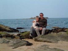
This week we’re tying up with Adam, Alison and Gemma who have a cottage not far from our campsite, and here we are having drinks in the warm sunshine. There are numerous islands in St Malo bay making it very picturesque, and if you carried on straight over Jane’s head for 30 miles, you’d arrive at Jersey.
The whole coastal region is prolific in oyster and mussel beds. I think they hide the oysters away as they command a premium price- one euro each- but mussels are more accessible. The photo shows a dense bed on the causeway to one of the nearest islands. Moules marinières feature on practically every restaurant menu in the area, always with chips. In Scotland the equivalent would be haggis and chips.
Thursday, 3 June 2010
May 26th: The Dordogne to Brittany
We left Brantôme for Dinan in Brittany, a distance of 350 miles and do-able in a day as it’s mainly motorway. The site at Dinan is two miles outside the town, near the river Rance estuary, and you can walk along the river path (see photo) to the Port of Dinan and then up into the town.
Dinan is on the high ground overlooking the river, so it’s a steep climb up a cobbled street to what is reputedly the best-preserved medieval town in Brittany. This is part of the ascent.
There are superb views from the ramparts because of the town’s elevation, and looking down over the river is one of the best. The river is tidal up to here although about 15 miles from the open sea, and the quays have an interesting mix of sea, river and canal boats.
The difference in building styles from the Dordogne, that we’ve just left, is very noticeable. Here it’s steep pitched slate roofs as opposed to terracotta tiles, and more angular buildings. That style applies to old and new structures alike, although the ancient buildings take a better photo so that’s what we’ve got below as an example.
The Place du Guesclin commemorates the town’s hero Bertrand du Guesclin who fought a single combat with an English knight in 1364. By winning the duel, Bertrand lifted the siege of the town. He later became Constable of France. Seems a big patch for just one constable, but we are talking medieval heroes here not today’s Dixon of Dock Green burdened with modern technology.
Subscribe to:
Posts (Atom)