Saturday, 11 April 2015

April 8th: Sequoia National Park Foothills

We’re now at the town of Visalia, with nothing much to commend it except it’s convenient for the Sequoia National Park. Poor old Visalia- it just has no personality, but isn’t grotty or unpleasant. This is a dead flat agricultural area and the mountains start about 40 miles away where the Park begins.

We’ve hired a car for a few days because the Park roads have hairpin bends and climb way up, so it’s not motorhome territory. The problem today is that it rained all day yesterday, and rain lowdown = snow on the mountains. But we decide to go anyway. At the entry lodge the ranger tells us only vehicles with snow chains can go right up, but we (without snow chains) can go up to 3,000 feet.


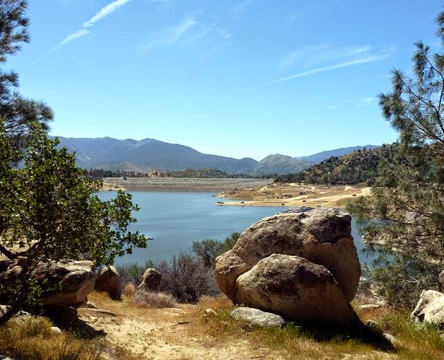
It’s a really picturesque drive, following above a rocky river. One huge boulder lies on its side near the road, the perfect photo opportunity if you want to stand on the top. We didn’t fancy a snap of one of us tumbling off it, so we took the sure-footed youngsters posing instead.
Our travel limit was Hospital Rock where there was a big carpark and picnic facilities like benches and barbie firepits. Hospital Rock was named after an adventurer whose wound had been tended by local Indians who cured it in rapid time. The Indians are long gone. The place had been a major settlement where evidence still remains of their activities. These rock paintings, for instance. The experts aren’t too sure what the symbols mean. 
Near the rock art is a boulder with smooth holes. The Indian women ground down acorns in these holes to make flour. Acorns were their staple diet. You can’t imagine, when we have so much choice in food today, living off so little variety. 
We walked a short trail from Hospital Rock along by the river, passing through a campground for tents only. Many of these campers would be backpackers since the Park has many miles of remote trails, and when you leave the vicinity of the one tarmac road that we are using, it is a real wilderness. This is emphasised by the brown boxes you can see between the trees. These are for the campers to store food in, all of their food, because the metal containers are bear-proof. Notices all over the Park describe how to deal with bears. My advice would be to make sure your smartphone or iPlayer has the song “Teddy Bears Picnic” loaded, and play it at full volume. Guaranteed to put them in a friendly mood. There are also mountain lion here, as well as the usual nasties like rattlesnakes.
Beyond the tents were some lovely unspoiled scenes although we weren’t that far into the outback, but we could still pretend we were explorers from a past age. But we didn’t see any bears or mountain lion, or get an arrow through either of our hats.


Thursday, 9 April 2015

March 30th to April 5th: Lake Isabella

The first half of the journey from Death Valley to Lake Isabella was along the remotest roads we had travelled. The rough tarmac surface gave way to dirt track for a few miles and then changed to good, smooth surface tarmac.

The photo shows part of the route; the road is the vanishing strip, centre right. Of course the AA would come out…if only we had a phone signal!
The campsite is right out in the country and the scrub meadow with mountains all around is across the fence behind our pitch. 
At 2,500 feet it’s a lot cooler than Death Valley but still warm enough to sit out and look for wildlife into the field. There are plenty of birds, from finches to vultures, but these are difficult to photograph. The Californian ground squirrel is quite the opposite: it stays motionless for hours on lookout duty like a meerkat. They’re about the same size as our UK grey squirrel.
The camp website shows the lake quite nearby, so we ask at reception if we can walk to the lake; there seem to be plenty of local dirt roads and footpaths in that direction. She said, yes, you used to be able to; in fact, you could see it from the campsite once upon a time. Now it’s 10 miles away…but you can catch a bus. This isn’t adding up- you can’t move a lake!

Internet to the rescue for detailed explanation. For once it’s not the chronic Californian drought that’s to blame. A dam was built in 1953 to contain the Kern River, creating one of the biggest man-made lakes in the state. In 2006 the dam was found to be leaking, so 40% of the reservoir was drained off and this is now the maximum permitted level. Obviously the lake has shrunk dramatically.
But why so long to repair the dam? Because there’s now another issue: it’s on an active earthquake faultline. That’s particularly bad news for the residents downstream of the dam. If the dam broke, a wall of water would follow the narrow Kern River canyon down to the city of Bakersfield, urban population around 500,000. A solution is being worked on; it could be a long time.  

So the water in the lake only just reaches the bottom of the dam. The dam is the grey strip running across the centre of the photo.
Even at its reduced level, it’s a really pretty lake. It’s still used for fishing and boating but much less than before so the local town has gone into a decline. With lower water levels there are more tracks around the lake and we spend a pleasant few hours walking around part of the shoreline. This is a selection of the views. You'll be pleased to know that Jane didn't take a running jump.

We also came across a Native American museum overlooking the lake that had many interesting local Indian objects, but didn’t put them into any historical context or describe the tribes customs and way of life before and after the coming of the settlers. Both Americans and Native Americans don’t seem that comfortable with presenting these facts; it’s something we’ve found in many places.

We also saw some original and talented rock paintings by one of the museum staff.
Back in the vicinity of the campsite we went for many splendid walks on those tracks that would have led to the lake a few years ago. This is a dried-up riverbed, which I suppose doesn’t matter so much if you’re not trying to fill the lake.
Lots of cowboy film tumbleweed. Jane’s stopped a big rolling ball here without even using her six-gun.
Our stay could have been a disaster, with what amounted to a false representation of the lake and the campsite itself wasn’t well run, but we thoroughly enjoyed our stay in this lovely area.


Wednesday, 8 April 2015

Sat 28th March: Scotty’s Castle

In all of Death Valley National Park’s  5,220 square miles ( 2/3 the size of Wales) there is but one opulent, extravagant building: Scotty’s Castle. Scotty neither built nor owned it, but was instrumental in its creation. Here’s a summary of the unusual story.

Scotty was an adventurer and a conman who claimed that he had found gold in Death Valley in the early years of the 20th century. He persuaded a number of investors from back East to put funds into his non-existent mine, including a Chicago businessman called Albert Johnson.

Johnson was rich, a millionaire, and also a mining engineer. After some years he decided to go and see this mine for himself. When he arrived in Death Valley he was confronted by a gunfight staged by Scotty, designed to scare him off, but Johnson was made of tougher stuff and stayed. He soon realised that there was no mine, but against all odds he and Scotty became firm friends.

Johnson thereafter frequently visited the valley with Scotty where the two enjoyed cowboy style living and adventures. Johnson came to believe that the hot dry climate was beneficial to his fragile health and thought a simple dwelling where he and his wife could live for part of the year would be a good idea. He found a good
site in one of the foothills with a large spring. Johnson’s wife was persuaded to view the location and fell in love with it.


However, ‘simple’ was not in Bessie Johnson’s vocabulary, so some of the best architects of the day were commissioned to design a suitably grand residence. Frank Lloyd Wright’s submission was rejected as too austere and they selected a Spanish Revival theme from another architect. It was started in 1922 and never fully finished. This is the premises.
On closer examination it’s a showpiece based on the in theme of the day for American millionaires. The great hall has a sort of plastic medieval film-set look. An interesting feature is that some of the walls were hollow to allow some of the spring water to flow through and provide cooling from the summer heat. Johnson the engineer was fascinated by technology, and incorporated the latest methods and gadgets wherever possible.
Of course the reason for the house’s extravagant appearance was to impress guests. This climaxed in the music room where whatever was playing on this piano (it played using cylinders) could be relayed throughout the estate from the bell tower outside. That’s the separate tower on the left in the first photo. 
The whole place is a time-capsule. Everything in it is original as installed by the Johnsons. This sideboard contains traditional Indian baskets made by the wives of the local Indian workers who laboured on the building of the castle, some of whom stayed on as estate workers. There’s even Bessie’s Singer sewing machine, bottom right. 
The house was powered by water turbine electricity, all concealed in a maze of underground tunnels that also ducted the cooling water into various rooms. The generator still works and was started up by our ranger guide; it illuminated some lightbulbs. 
Changes in water flow or sudden demands on the current caused the lights to flicker sometimes, and this got on perfectionist Johnson’s nerves. His solution was to install a massive bank of batteries that would accumulate the current and then release it at a uniform rate. The batteries are still there and in working order.
Hot water was created from thermal energy, making Johnson one of the earliest eco warriors. His ingenuity was more from necessity than any thoughts of saving the planet, but it worked really well. Spring water was run through metal containers (not now there) supported by the wooden framework in the photo. The fierce sun heated up the water that was then stored in the large insulated tank behind before being pumped into the house via the service tunnels. 
Scotty himself, full name Walter Scott, was well provided for. He had the run of the “castle” and Johnson even built him a place of his own on the estate. Johnson’s will also left Scotty the use of the place should he survive him, which he did by 6 years, and is in fact buried on a small hill behind the house.

There were separate guest quarters, stables and garaging for several vehicles. Johnson’s favourite was a 7 seater 1914 Packard, a bit ancient in the mid 20’s, but a quality car in which they would trundle round the valley if not riding horses. What sort of bone jarring ride the car gave is anyone’s guess with its solid tyres on rough dirt roads.
There was a lot more detail to the story. Like Death Valley itself, it had more depth and interest than was first apparent.

Death Valley was indeed a unique and rewarding experience. Now onwards and upwards, to Lake Isabella.


Monday, 6 April 2015

Death Valley: Golden Canyon and Badwater

Golden Canyon is about four miles from the campsite so we take the motorhome and park in the canyon car park. It’s pretty full but we get a spot; manoeuvring a motorhome into irregular areas is no way as easy as a car.The canyon entrance is narrow and steep, but Jane is through it like a mountain goat.
The path soon levels off into an easy track but climbing all the time. And it’s hot, really hot. The different rock colours and formations are most unusual, so here are three photos to show how varied they are. They canyon is totally quiet; some might say we need some piped-in rock music.

We’re nearly at the top, where the dark red rocks called the Cathedral form an impenetrable wall. It’s all a lunar landscape, with Jane’s small steps for a woman and giant leaps for womankind taking us ever onwards.
Looking back the way we came gives us a view of snow-covered Telescope Peak in the Sierra Nevada range on the other side of Death Valley. 
It’s easier going down, as always. We then take the camper 20 miles further to Badwater Creek where we have lunch onboard. Badwater Creek was so named because an early explorer couldn’t get his mule to drink from the shallow creek here. Hardly surprising as it’s part of large salt-flats.
A part of the flats has been set aside for visitor access. Anyone brought their ice skates?
An information board at Badwater gave record temperatures for each month. Today was 29th March, and the March record was 102F. It seemed incredibly hot to us so on our return we checked back with the live thermometer at the Visitor Centre near the campsite.
We knew it was hot!


Sunday, 5 April 2015

Death Valley: Harmony Borax Works

Borax deposits were discovered in Death Valley in 1881 and claims laid by a certain William Coleman. A processing plant opened in 1883 and operated until 1888 when Coleman’s business collapsed. This is what’s left of the works.
The borax was mined and processed here by up to 40 labourers who were mostly Chinese. They lived in tents and were paid at a lower rate than Americans. This is the area of the desert where they lived and worked. Not much of a fun place.
The borax ore was dissolved in boiling water generated by a steam engine, and crystallised in the iron troughs shown in the photo below. Operations were transferred during the summer months to a slightly cooler location in the valley not for any consideration for the workers but because borax won’t crystallise above 120F. 
Now they’ve got borax crystals- what to do with them in the middle of nowhere? Borax is a much sought after chemical used in many everyday products, so they needed to get it to where the factories were, back East; they needed a railhead. So they put the borax into two box carts with a water container at the back, hitched up 20 mules, and drove it across the desert and over mountain passes the 165 miles to the nearest railway station at the town of Mojave. They made this journey, there and back, countless times over the five years of Harmony Mine’s existence, using the set-up in the photo. You'll have to imagine the mules, but make sure you add them to the right end. They sure were tough in them thar days.


Saturday, 4 April 2015

Creatures around Furnace Creek

Wednesday 25th March, we are up early to join the 6:30 am bird walk with a ranger. It’s cool but not cold, and we see the sunrise on the distant mountains long before it reaches us. 
You’ll be thinking that the pond and green area could be a golf course. Well, it is; Furnace Creek uses groundwater to support a golf course. The immediate vicinity is a wonderful habitat for all sorts of wildlife. You can’t see them in the photo but there’s a pack of coyotes in the gap between the trees. We were able to snap one later at much closer quarters when it quickly trotted past us having emerged from the undergrowth.
The ranger said the coyotes have learned to catch the ducks on the lake in the golf course.

We saw several, but not many, unusual birds. Nothing posed for the camera. This one’s just about ok, of a bird called a verdin making a nest. 100 Tesco points for spotting the bird in the photo.
There were many common birds around during our week’s stay, like grackles, ravens, vultures and sparrows.

Plenty of lizards everywhere. This one has a blue tail.
Dragonflies too, near any still water. This an orange one.
Many desert creatures are nocturnal, like the kangaroo rat that can go for months without drinking. Snakes and scorpions lurk, and while we didn’t see any snakes, a ranger turned up a scorpion for us on a night hunt.  

A topic of discussion everywhere in California right now is water conservation. The State is officially a drought area due to climate change. The Governor declared a 25% water reduction target across the board only a few days ago. One aspect of the debate is water usage to maintain ornamental grass areas, parks and golf courses. The golf course here in Death Valley must take massive amounts of water to survive: it gets 2 inches of rain and evaporates at the rate of 150 inches per year. It looks especially beautiful and lush being here in the desert and it does, of  course, support a wildlife habitat, as well as provide recreation. Difficult priorities to determine, but at least no one is proposing to restrict water to the brewing industry!  


Friday, 3 April 2015

Fish in the Desert

Most photos and descriptions dwell on the extreme conditions in Death Valley. It averages only 2 inches of rain each year. It can freeze at night in winter and the summer temperatures frequently top 120F (49C). It holds the world record high of 134F (57C). You would expect wildlife to be virtually non-existent.


Surprisingly, there’s a great variety. Wildlife learned to adapt and also to benefit from man’s intervention in the valley. There is even one variety of fish left from the giant lake that filled the valley 10,000 years ago. The pupfish lives, impossibly, in these highly salty rivulets. 
The fish is about an inch long and looks like this. The water is teeming with them when you peer into the streams.
We were here on a ranger led activity, and he took us along the boardwalk, following the stream towards the source where the pupfish population must migrate to endure the scorching summer heat. The lower water course dries up and some fish don’t make it. The ranger also explained other aspects of this environment, for example how some of the plants in the photo deal with the excess salt by storing it in special leaves.
There are four pupfish species in separate locations in different parts of the valley. One of these species lives in a deep natural well, also used by locals for irrigation, and is nearly extinct. To put it bluntly, these fish have nearly had their chips.

A protection order was recently placed on the well so the locals were forbidden to use it. Their response to the plight of the pupfish was to throw old car batteries into the well. Finish them off and we get our water back.

There are two sides to most things, and the locals would understandably see their livelihoods as more important than a few insignificant minnow sized fish. The well is now securely fenced off. Anyone need some old car batteries?