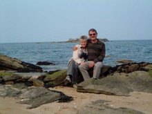
We
decided to take an organised tour as the motorhome isn’t ideal for mountain
roads, although we observed during the tour that some motorhomers didn’t share
that view. They were to be found in the most narrow, twisty, high elevations,
in spite of warning signs. Maybe we’re getting soft in our old age!
The
tour picked us up from the campsite, a 25 mile picturesque run to the Yosemite
Park entrance. We followed the Merced River in a steep canyon for much of the
way. It was an area exploited for gold after the California goldrush of 1849.
Gold is still panned from the river today, but not in quantity. Some of the old
goldmining building were pointed out by our guide as we went alongside the
river. The one in the photo would convert into a great McDonalds- just think how
popular chicken McNuggets would be.
Entering
Yosemite Valley is like entering a hidden world. It was unknown to Westerners until
the 1849 goldrush and was occupied, on and off, by the Awaneechee tribe. They
were forcibly removed after violent clashes with the goldminers who had commandeered
their ancestral tribal lands. Haven’t we come across that scenario before?
The
Valley is a wonderland of waterfallls and cliffs with the scenic Merced River meandering
over the flat valley floor. The valley stretches for 7 miles with a one-way loop
road for access. Following this road, the first major landmark is the El
Capitan rock, a 7,500 mountain of solid granite sticking up 3,000 feet from the
valley floor.
It
is acknowledged to be the world’s most difficult rock climbs due to its very
smooth vertical face. Our guide, who was a climber himself, had spotted some
heroes on the face, inching up the pitch. You can barely see the two dots which
are the climbers. It can take many days to climb from base to top, and portable
ledges (4ft by 7 ft) are taken up as part of the climbing equipment to sleep
on. Don’t sleep walk whatever you do.
There
was still some snow on the mountain tops from the fall a few days ago. As with
the rest of California, in the last four years Yosemite has seen significantly
less rain and snow so is not supplying water into the reservoirs. Here’s
a sample of that lovely scenery.
We
saw mule deer several times. These are common in the park, and looked
particularly at home in the setting underneath on the banks of the Merced
River. They’re the dots on the riverbank, on the right.
This
is the highest waterfall in America and one of the highest in the world:
Yosemite Falls, 2,425 feet in three cascades. It’s an optical illusion, but it
appears that Jane on the path is getting a soaking from the lower cascade.
There
is only one hotel in Yosemite, the Ahwahnee Hotel, and it’s 5*+. US Presidents
have stayed, as has our own QE2. We sneaked in and got this view from the
garden. Wouldn’t swap it for our motorhome, though.
After
leaving the Awahnee, the tour leaves the valley floor at 4,000 feet to climb to
Glacier Point at 7,200 feet, to look down on the valley. Glacier Point is the
lefthand peak in the photo above.
We
start the climb. I’m now really pleased we weren’t tempted to take the
motorhome. Halfway up we stopped at a
wonderful viewpoint that looks along the whole valley.
The
minibus got way over the snowline at 8,000 feet and rewarded us with some views
of mountain ranges feeding into Yosemite, like the Clark Range shown in the next
photo.
We arrived at Glacier Point, and ate our packed lunches overlooking some
staggering scenery. How many more waterfalls can you handle?
For
me the most striking view was the Half-Dome, an 8,800 foot granite pillar that
is also a favourite of the climbing fraternity, but no performers today.
In
this age of colour photography we tend to forget how dramatic black and white can
be for certain shots, and I think this photo above is one of them so I’ve reproduced
it as such below. It’s also reminiscent of the style of a famous American
photographer called Ansel Adams. Must get the old box Brownie camera out of the
loft.


No comments:
Post a Comment