Tuesday, 21 April 2015

Mariposa Grove

We called in here as the last part of the Yosemite tour just outside the main park. More sequoia, the mountain giant redwoods. This massive tree, with me skulking alongside it, is about 1,000 years old.
An even more remarkable photo is that of a tree that toppled over about 300 years ago. Because of the tannic acid in the bark, redwoods are almost indestructible alive or dead. I must start sprinkling redwood bark dust on my breakfast cereal. Jane, standing by the roots, gives an idea of the size.
You would walk straight past these two green saplings. They’re about a foot tall, and the significance is that the one on the right, a pine tree, is two years old, whilst the left hand one is a sequoia and is fourteen years old. That’s how slowly they grow.
Next our guide points out a patch of snapgrass that the Native Americans used for cleaning and scouring. It’s about three feet high and snaps off easily at the joints on each blade, hence the name. It is also rough enough to use as sandpaper. 
Many strange plants inhabit the forest, like this one, a snow flower. 
We learned so much about the forest and Yosemite in general from Saul, our knowledgeable guide. Another remarkable experience. 


Sunday, 19 April 2015

Sunday 12th April: Yosemite

We decided to take an organised tour as the motorhome isn’t ideal for mountain roads, although we observed during the tour that some motorhomers didn’t share that view. They were to be found in the most narrow, twisty, high elevations, in spite of warning signs. Maybe we’re getting soft in our old age!


The tour picked us up from the campsite, a 25 mile picturesque run to the Yosemite Park entrance. We followed the Merced River in a steep canyon for much of the way. It was an area exploited for gold after the California goldrush of 1849. Gold is still panned from the river today, but not in quantity. Some of the old goldmining building were pointed out by our guide as we went alongside the river. The one in the photo would convert into a great McDonalds- just think how popular chicken McNuggets would be.
Entering Yosemite Valley is like entering a hidden world. It was unknown to Westerners until the 1849 goldrush and was occupied, on and off, by the Awaneechee tribe. They were forcibly removed after violent clashes with the goldminers who had commandeered their ancestral tribal lands. Haven’t we come across that scenario before?

The Valley is a wonderland of waterfallls and cliffs with the scenic Merced River meandering over the flat valley floor. The valley stretches for 7 miles with a one-way loop road for access. Following this road, the first major landmark is the El Capitan rock, a 7,500 mountain of solid granite sticking up 3,000 feet from the valley floor. 
It is acknowledged to be the world’s most difficult rock climbs due to its very smooth vertical face. Our guide, who was a climber himself, had spotted some heroes on the face, inching up the pitch. You can barely see the two dots which are the climbers. It can take many days to climb from base to top, and portable ledges (4ft by 7 ft) are taken up as part of the climbing equipment to sleep on. Don’t sleep walk whatever you do.
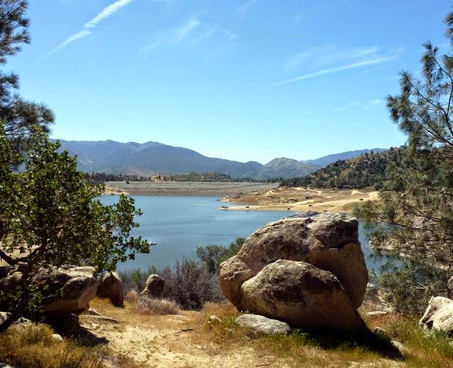
There was still some snow on the mountain tops from the fall a few days ago. As with the rest of California, in the last four years Yosemite has seen significantly less rain and snow so is not supplying water into the reservoirs. Here’s a sample of that lovely scenery.
We saw mule deer several times. These are common in the park, and looked particularly at home in the setting underneath on the banks of the Merced River. They’re the dots on the riverbank, on the right. 
This is the highest waterfall in America and one of the highest in the world: Yosemite Falls, 2,425 feet in three cascades. It’s an optical illusion, but it appears that Jane on the path is getting a soaking from the lower cascade.
There is only one hotel in Yosemite, the Ahwahnee Hotel, and it’s 5*+. US Presidents have stayed, as has our own QE2. We sneaked in and got this view from the garden. Wouldn’t swap it for our motorhome, though.
After leaving the Awahnee, the tour leaves the valley floor at 4,000 feet to climb to Glacier Point at 7,200 feet, to look down on the valley. Glacier Point is the lefthand peak in the photo above.

We start the climb. I’m now really pleased we weren’t tempted to take the motorhome.  Halfway up we stopped at a wonderful viewpoint that looks along the whole valley.
The minibus got way over the snowline at 8,000 feet and rewarded us with some views of mountain ranges feeding into Yosemite, like the Clark Range shown in the next photo.
We arrived at Glacier Point, and ate our packed lunches overlooking some staggering scenery. How many more waterfalls can you  handle?
For me the most striking view was the Half-Dome, an 8,800 foot granite pillar that is also a favourite of the climbing fraternity, but no performers today.
In this age of colour photography we tend to forget how dramatic black and white can be for certain shots, and I think this photo above is one of them so I’ve reproduced it as such below. It’s also reminiscent of the style of a famous American photographer called Ansel Adams. Must get the old box Brownie camera out of the loft.


Sunday, 12 April 2015

April 9th: Sequoia Nat Park: the Big Trees

Presenting ourselves at the Park entrance today, the ranger said that the road is now open. So up we go, past Hospital Rock, yesterday’s furthest point, after which the road starts to climb steeply in a series of hairpin bends. The weather’s good, but a little hazy, so photo long shots look a bit flat, which is a shame because there are some great viewpoint pull offs. 
The snow line starts around 5,000 feet, as do the sequoias. The sequoia is also known as the giant redwood and grows naturally in a limited area high up on the western slopes of the Sierra Nevada Mountains. The coastal redwood, the other species, grows taller but less bulky and is naturally only found along a narrow coastal strip of central and northern California.  

The first sequoias we come to look massive, for example these flanking the road. Sudden thought- does the hire car insurance cover collision with a giant redwood? 
At 6,400 feet altitude there’s a visitor centre full of sequoia information. They can live for over 2,000 years and grow over 300 feet tall. The visitor centre used to be run as a souvenir shop and cafeteria until the Park authorities decided to de-commercialise their operations. Very commendable you might say, but Jane and I could murder a coffee and bun right now. See photo of non-commercial visitor centre and, on the left, what’s labelled as an “average size” sequoia. Average size elephants still look impressive.
Leaving the visitor centre, we drive on upwards a further 3 miles to walk in the Giant Grove. From the car park the path leads through patchy snow for half a mile to where these big trees are scattered within a forest of mixed, but mainly pine, trees. The car park was quite full, say 100 cars, and it’s amazing how many people are walking to the Grove dresses in shorts and flip-flops or trainers.

Many of the big trees are set back in the forest where the snow is still deep so we don’t venture off the path. Some are next to the path, like “The Twins”. It’s always handy to have a couple of people nearby to give a sense of scale.
But now for the really big one, General Sherman. Jane is standing in the middle of a paved area that is an exact replica of the size of the of the tree’s base. It has a girth of 103 feet.
The General Sherman tree is estimated to be 2,200 years old, and is 277 feet tall, weighing 1,256 tonnes. It is the largest single-stemmed living thing on the planet. Luckily again, there are some people in the photo to give it scale. It would certainly fill a lot of matchboxes.
The sequoia are now protected but were logged profusely in the past even to the extent of cutting down a number in the 1880’s to send back intact to the East to prove to the sceptics there that such huge trees existed. It took two men 13 days to saw one of the trees through, such was its size.

As we plodded back the half mile to the car park along the slushy path we realised that we had had a unique encounter. We almost forgot about the coffee and buns.


Saturday, 11 April 2015

April 8th: Sequoia National Park Foothills

We’re now at the town of Visalia, with nothing much to commend it except it’s convenient for the Sequoia National Park. Poor old Visalia- it just has no personality, but isn’t grotty or unpleasant. This is a dead flat agricultural area and the mountains start about 40 miles away where the Park begins.

We’ve hired a car for a few days because the Park roads have hairpin bends and climb way up, so it’s not motorhome territory. The problem today is that it rained all day yesterday, and rain lowdown = snow on the mountains. But we decide to go anyway. At the entry lodge the ranger tells us only vehicles with snow chains can go right up, but we (without snow chains) can go up to 3,000 feet.


It’s a really picturesque drive, following above a rocky river. One huge boulder lies on its side near the road, the perfect photo opportunity if you want to stand on the top. We didn’t fancy a snap of one of us tumbling off it, so we took the sure-footed youngsters posing instead.
Our travel limit was Hospital Rock where there was a big carpark and picnic facilities like benches and barbie firepits. Hospital Rock was named after an adventurer whose wound had been tended by local Indians who cured it in rapid time. The Indians are long gone. The place had been a major settlement where evidence still remains of their activities. These rock paintings, for instance. The experts aren’t too sure what the symbols mean. 
Near the rock art is a boulder with smooth holes. The Indian women ground down acorns in these holes to make flour. Acorns were their staple diet. You can’t imagine, when we have so much choice in food today, living off so little variety. 
We walked a short trail from Hospital Rock along by the river, passing through a campground for tents only. Many of these campers would be backpackers since the Park has many miles of remote trails, and when you leave the vicinity of the one tarmac road that we are using, it is a real wilderness. This is emphasised by the brown boxes you can see between the trees. These are for the campers to store food in, all of their food, because the metal containers are bear-proof. Notices all over the Park describe how to deal with bears. My advice would be to make sure your smartphone or iPlayer has the song “Teddy Bears Picnic” loaded, and play it at full volume. Guaranteed to put them in a friendly mood. There are also mountain lion here, as well as the usual nasties like rattlesnakes.
Beyond the tents were some lovely unspoiled scenes although we weren’t that far into the outback, but we could still pretend we were explorers from a past age. But we didn’t see any bears or mountain lion, or get an arrow through either of our hats.


Thursday, 9 April 2015

March 30th to April 5th: Lake Isabella

The first half of the journey from Death Valley to Lake Isabella was along the remotest roads we had travelled. The rough tarmac surface gave way to dirt track for a few miles and then changed to good, smooth surface tarmac.

The photo shows part of the route; the road is the vanishing strip, centre right. Of course the AA would come out…if only we had a phone signal!
The campsite is right out in the country and the scrub meadow with mountains all around is across the fence behind our pitch. 
At 2,500 feet it’s a lot cooler than Death Valley but still warm enough to sit out and look for wildlife into the field. There are plenty of birds, from finches to vultures, but these are difficult to photograph. The Californian ground squirrel is quite the opposite: it stays motionless for hours on lookout duty like a meerkat. They’re about the same size as our UK grey squirrel.
The camp website shows the lake quite nearby, so we ask at reception if we can walk to the lake; there seem to be plenty of local dirt roads and footpaths in that direction. She said, yes, you used to be able to; in fact, you could see it from the campsite once upon a time. Now it’s 10 miles away…but you can catch a bus. This isn’t adding up- you can’t move a lake!

Internet to the rescue for detailed explanation. For once it’s not the chronic Californian drought that’s to blame. A dam was built in 1953 to contain the Kern River, creating one of the biggest man-made lakes in the state. In 2006 the dam was found to be leaking, so 40% of the reservoir was drained off and this is now the maximum permitted level. Obviously the lake has shrunk dramatically.
But why so long to repair the dam? Because there’s now another issue: it’s on an active earthquake faultline. That’s particularly bad news for the residents downstream of the dam. If the dam broke, a wall of water would follow the narrow Kern River canyon down to the city of Bakersfield, urban population around 500,000. A solution is being worked on; it could be a long time.  

So the water in the lake only just reaches the bottom of the dam. The dam is the grey strip running across the centre of the photo.
Even at its reduced level, it’s a really pretty lake. It’s still used for fishing and boating but much less than before so the local town has gone into a decline. With lower water levels there are more tracks around the lake and we spend a pleasant few hours walking around part of the shoreline. This is a selection of the views. You'll be pleased to know that Jane didn't take a running jump.

We also came across a Native American museum overlooking the lake that had many interesting local Indian objects, but didn’t put them into any historical context or describe the tribes customs and way of life before and after the coming of the settlers. Both Americans and Native Americans don’t seem that comfortable with presenting these facts; it’s something we’ve found in many places.

We also saw some original and talented rock paintings by one of the museum staff.
Back in the vicinity of the campsite we went for many splendid walks on those tracks that would have led to the lake a few years ago. This is a dried-up riverbed, which I suppose doesn’t matter so much if you’re not trying to fill the lake.
Lots of cowboy film tumbleweed. Jane’s stopped a big rolling ball here without even using her six-gun.
Our stay could have been a disaster, with what amounted to a false representation of the lake and the campsite itself wasn’t well run, but we thoroughly enjoyed our stay in this lovely area.


Wednesday, 8 April 2015

Sat 28th March: Scotty’s Castle

In all of Death Valley National Park’s  5,220 square miles ( 2/3 the size of Wales) there is but one opulent, extravagant building: Scotty’s Castle. Scotty neither built nor owned it, but was instrumental in its creation. Here’s a summary of the unusual story.

Scotty was an adventurer and a conman who claimed that he had found gold in Death Valley in the early years of the 20th century. He persuaded a number of investors from back East to put funds into his non-existent mine, including a Chicago businessman called Albert Johnson.

Johnson was rich, a millionaire, and also a mining engineer. After some years he decided to go and see this mine for himself. When he arrived in Death Valley he was confronted by a gunfight staged by Scotty, designed to scare him off, but Johnson was made of tougher stuff and stayed. He soon realised that there was no mine, but against all odds he and Scotty became firm friends.

Johnson thereafter frequently visited the valley with Scotty where the two enjoyed cowboy style living and adventures. Johnson came to believe that the hot dry climate was beneficial to his fragile health and thought a simple dwelling where he and his wife could live for part of the year would be a good idea. He found a good
site in one of the foothills with a large spring. Johnson’s wife was persuaded to view the location and fell in love with it.


However, ‘simple’ was not in Bessie Johnson’s vocabulary, so some of the best architects of the day were commissioned to design a suitably grand residence. Frank Lloyd Wright’s submission was rejected as too austere and they selected a Spanish Revival theme from another architect. It was started in 1922 and never fully finished. This is the premises.
On closer examination it’s a showpiece based on the in theme of the day for American millionaires. The great hall has a sort of plastic medieval film-set look. An interesting feature is that some of the walls were hollow to allow some of the spring water to flow through and provide cooling from the summer heat. Johnson the engineer was fascinated by technology, and incorporated the latest methods and gadgets wherever possible.
Of course the reason for the house’s extravagant appearance was to impress guests. This climaxed in the music room where whatever was playing on this piano (it played using cylinders) could be relayed throughout the estate from the bell tower outside. That’s the separate tower on the left in the first photo. 
The whole place is a time-capsule. Everything in it is original as installed by the Johnsons. This sideboard contains traditional Indian baskets made by the wives of the local Indian workers who laboured on the building of the castle, some of whom stayed on as estate workers. There’s even Bessie’s Singer sewing machine, bottom right. 
The house was powered by water turbine electricity, all concealed in a maze of underground tunnels that also ducted the cooling water into various rooms. The generator still works and was started up by our ranger guide; it illuminated some lightbulbs. 
Changes in water flow or sudden demands on the current caused the lights to flicker sometimes, and this got on perfectionist Johnson’s nerves. His solution was to install a massive bank of batteries that would accumulate the current and then release it at a uniform rate. The batteries are still there and in working order.
Hot water was created from thermal energy, making Johnson one of the earliest eco warriors. His ingenuity was more from necessity than any thoughts of saving the planet, but it worked really well. Spring water was run through metal containers (not now there) supported by the wooden framework in the photo. The fierce sun heated up the water that was then stored in the large insulated tank behind before being pumped into the house via the service tunnels. 
Scotty himself, full name Walter Scott, was well provided for. He had the run of the “castle” and Johnson even built him a place of his own on the estate. Johnson’s will also left Scotty the use of the place should he survive him, which he did by 6 years, and is in fact buried on a small hill behind the house.

There were separate guest quarters, stables and garaging for several vehicles. Johnson’s favourite was a 7 seater 1914 Packard, a bit ancient in the mid 20’s, but a quality car in which they would trundle round the valley if not riding horses. What sort of bone jarring ride the car gave is anyone’s guess with its solid tyres on rough dirt roads.
There was a lot more detail to the story. Like Death Valley itself, it had more depth and interest than was first apparent.

Death Valley was indeed a unique and rewarding experience. Now onwards and upwards, to Lake Isabella.