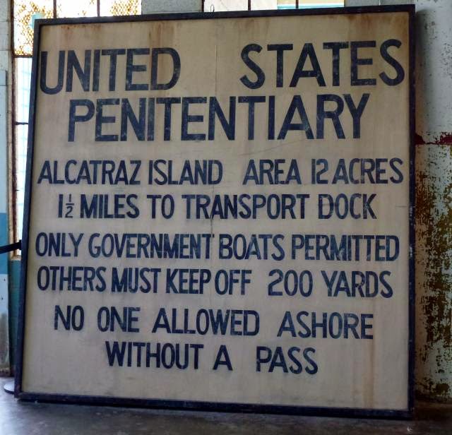
Monday 27 April 2015

Monday 21st April: Alcatraz

Alcatraz lies in San Francisco bay 1½ miles off-shore. Soon after California became part of the USA in 1848, Alcatraz was turned into a military fortress and then in 1867/8 became a military prison. In 1933 the US Dept. of Justice took it over as a federal penitentiary to house the country’s most difficult convicts. The first prisoners were installed in 1934, and the jail served in that capacity for the next 29 years. The island was totally self-sufficient, with a power generation plant, food processing, laundry etc. Water was shipped over in bulk.

The next photo is taken from the boat taking us to Alcatraz and shows the island’s rocky profile and isolation, making it an ideal prison location. The bay waters are cold throughout the year, so discouraging an escape attempt by swimming. The prison block is the building right on the top of the island.
 Official business only! This notice greeted all who approached too close.
This was a no-nonsense prison. Warders were called correction officers and tight discipline was enforced with armed guards patrolling from behind a barred gallery so they could not be overpowered and their weapons seized. They were guarding these three-tiered cell corridors, of which there were three main corridors and an isolation block. This is the central corridor known as Broadway.
Individual cells throughout looked like this. They housed major criminals like Al Capone, Alvin “Creepy” Karpis, and “Machine Gun” Kelly. 
“D” Block, or the isolation section, was reserved for the most troublesome prisoners. The most famous of these was Robert Stroud, the “Birdman of Alcatraz”. He spent all of his 17 years here in isolation due to his extremely violent history, including killing a prison guard for which he narrowly missed the death penalty. This is the “D” Block
Yet Stroud was a very intelligent man who had become a world expert on canaries at his previous prison where he finally killed the guard and got transferred to Alcatraz. He was denied access to his bird studies as part of his punishment. This is what Stroud looked like.
There was a more severe regime available in “D” Block: the “Hole”. These were solitary confinement cells where a restricted diet and total darkness was sometimes applied. Those deemed to deserve such treatment were held there for several days, up to a maximum of 19.
There was a daily recreation period, to be taken in the exercise yard.  Bridge was especially popular and the men stayed outside for the full term of several hours even in the bitter cold. The yard looks a forbidding place, as you can see. Reminds me of my old school playground.
There were 14 separate escape attempts and the official line was that no convicts made it. The bloodiest attempt was in 1946 when three convicts and two guards died.

The attempt in 1962 was, and still is, the most intriguing. Three prisoners made dummy heads for their beds so that the guards saw them “asleep” when they made their regular inspections. Supposedly in bed, they headed up a ventilation shaft that led out onto the roof. They had with them 50 rubber raincoats from other inmates that made into a raft, and wooden paddles scrounged from other sources. They planned to climb down from the roof, reach the sea, and paddle away.

The official version is that they drowned, but no bodies were ever found, although bits of the raft and paddles were discovered on the shore of another island in the bay. However, there were reported sightings of the men for many years afterwards and the families claimed to have received postcards in the men‘s handwriting. The US Marshall’s file will remain open until they all reach the age of 100.  

The prison closed in 1963 and lay abandoned for 6 years until occupied by Native Americans demanding just treatment for the return and self-government of Indian territories. They were there for two years. This high water tower is still inscribed with slogans for their cause that sought to generate public sympathy. Their campaign was partly successful and a turning point in the government’s attitude to Indian administration within their own lands. The Prison Governor’s old residence was accidentally burnt down during their occupation. 
Another kind of protest was taking place on Alcatraz during our visit, this time with official approval. Art activist Ai Weiwei was exhibiting a set of dissidents’ faces from repressive political regime. They are all made from Lego and are divided into world sections. He himself can’t leave China for his political statements through his art. So he’s a kind of prisoner, exhibiting the faces of many who are in prison, in a prison. Very appropriate.
This final photo sums up, for me, the chilly, moody atmosphere of Alcatraz, looking from the island towards the misty Golden Gate Bridge over a grey, cold sea.  


Saturday 25 April 2015

April 16th/17th : San Francisco

San Francisco is a city associated with big events and times: the 1849 goldrush, the earthquake of 1906, the Golden Gate Bridge (opened in 1937), hippies in the 60’s and flowerpower in the 70’s, Alcatraz, and so on. My thoughts before visiting  San Francisco were- how would the city square up to its image?


Well, the Golden Gate Bridge didn’t disappoint. The hop-on/hop-off bus trundled off to the bridge as one of its first stops, and very impressive (and windy) it was too. When it opened, it was the longest single-span bridge in the world. The colour is called International Orange, more rust than orange to me, and would you buy an orange that colour in the supermarket?
And are those street as steep as they look in photos? Some of them really are, and here are the famous cable cars that ply these slopes. Between 1873 and 1890, twenty three cable car lines were created; only three now remain, largely as tourist attractions. The cable cars were introduced by a Mr Andrew Hallidie to alleviate the suffering to the horses that hauled goods up and down the city’s perilous gradients and sometimes slipped and fell. 
Lombard Street is reckoned to be the steepest street in the world. The top part has a natural slope of 27%, that’s steeper than 1 in 4, but is modified by a series of 8 hairpin bends so that vehicles can safely manage the incline.  
The hippy and flowerpower area of yesteryear still maintains an ‘alternative’ appearance with brightly coloured shops, and associations with famous musicians who lived there. This was Jimmi Hendrix’ house, although I can’t imagine he had his face painted on the side when he lived there.
The hop-on/hop-off guide said pot (cannabis) was freely and legally available, as the next photo indicates. The sign says “Day Dream Smoke Shop”. There were quite a lot of drifters around that seemed to be keeping in touch with the ‘change the world’ culture of the 60/70’s, but the reallity is that the world itself has changed a lot since then and sadly left them behind.
A more cheery sight was to be found in the harbour. Pier 39 has been the site for many years of a congregation of sea lions. Hundreds gather there on wooden rafts, with the dominant bulls displaying their prowess and making a huge noise by constant barking and grunting
Nearly a quarter of San Francisco’s population is of Chinese origin.Chinese culture and language is very much alive, to the extent that chinese rather than english is the first language for many.  China Town is the original Chinese quarter but these days this is as much a tourist attraction as a residential district. The shops and buildings were quite different from the rest of the city so it made an interesting walk-through.
San Francisco was a town full of victorian houses until the earthquake of 1906. The fire following the earthquake destroyed most of the wooden buildings. But some survived and are preserved as architectural treasures. Here are a couple of photos, but probably not the best of them.

Modern buildings dominate the skyine in the financial district, but nothing on the scale of the cities in Eastern America. Another two photos give examples that show pleasant modern designs.

The city will always be associated with Tony Bennet’s song, ‘I left My Heart In San Francisco’. The words and music endear you to all of San Francisco’s charms, even the fog that is actually clammy and unpleasant.

Tony Bennet is himself a New Yorker, but really does have a soft spot  for San Francisco. He should do, the song’s earned him a lot of money! Also, Tony is an artist, and has painted the heart that he left behind. Here it is, in the central square, featuring also the bloke on the left’s behind that he’s in the process of taking with him.
Our verdict is that San Francisco was an interesting  and compact city, so fairly easy to see in a short time. However, although three days of visiting a city is hardly enough to know it properly, we couldn’t say we would be drawn back to it- so we didn’t leave our hearts there.

But we’ve not finished with San Francisco yet: the following blog is Alcatraz.


Tuesday 21 April 2015

Mariposa Grove

We called in here as the last part of the Yosemite tour just outside the main park. More sequoia, the mountain giant redwoods. This massive tree, with me skulking alongside it, is about 1,000 years old.
An even more remarkable photo is that of a tree that toppled over about 300 years ago. Because of the tannic acid in the bark, redwoods are almost indestructible alive or dead. I must start sprinkling redwood bark dust on my breakfast cereal. Jane, standing by the roots, gives an idea of the size.
You would walk straight past these two green saplings. They’re about a foot tall, and the significance is that the one on the right, a pine tree, is two years old, whilst the left hand one is a sequoia and is fourteen years old. That’s how slowly they grow.
Next our guide points out a patch of snapgrass that the Native Americans used for cleaning and scouring. It’s about three feet high and snaps off easily at the joints on each blade, hence the name. It is also rough enough to use as sandpaper. 
Many strange plants inhabit the forest, like this one, a snow flower. 
We learned so much about the forest and Yosemite in general from Saul, our knowledgeable guide. Another remarkable experience. 


Sunday 19 April 2015

Sunday 12th April: Yosemite

We decided to take an organised tour as the motorhome isn’t ideal for mountain roads, although we observed during the tour that some motorhomers didn’t share that view. They were to be found in the most narrow, twisty, high elevations, in spite of warning signs. Maybe we’re getting soft in our old age!


The tour picked us up from the campsite, a 25 mile picturesque run to the Yosemite Park entrance. We followed the Merced River in a steep canyon for much of the way. It was an area exploited for gold after the California goldrush of 1849. Gold is still panned from the river today, but not in quantity. Some of the old goldmining building were pointed out by our guide as we went alongside the river. The one in the photo would convert into a great McDonalds- just think how popular chicken McNuggets would be.
Entering Yosemite Valley is like entering a hidden world. It was unknown to Westerners until the 1849 goldrush and was occupied, on and off, by the Awaneechee tribe. They were forcibly removed after violent clashes with the goldminers who had commandeered their ancestral tribal lands. Haven’t we come across that scenario before?

The Valley is a wonderland of waterfallls and cliffs with the scenic Merced River meandering over the flat valley floor. The valley stretches for 7 miles with a one-way loop road for access. Following this road, the first major landmark is the El Capitan rock, a 7,500 mountain of solid granite sticking up 3,000 feet from the valley floor. 
It is acknowledged to be the world’s most difficult rock climbs due to its very smooth vertical face. Our guide, who was a climber himself, had spotted some heroes on the face, inching up the pitch. You can barely see the two dots which are the climbers. It can take many days to climb from base to top, and portable ledges (4ft by 7 ft) are taken up as part of the climbing equipment to sleep on. Don’t sleep walk whatever you do.
There was still some snow on the mountain tops from the fall a few days ago. As with the rest of California, in the last four years Yosemite has seen significantly less rain and snow so is not supplying water into the reservoirs. Here’s a sample of that lovely scenery.
We saw mule deer several times. These are common in the park, and looked particularly at home in the setting underneath on the banks of the Merced River. They’re the dots on the riverbank, on the right. 
This is the highest waterfall in America and one of the highest in the world: Yosemite Falls, 2,425 feet in three cascades. It’s an optical illusion, but it appears that Jane on the path is getting a soaking from the lower cascade.
There is only one hotel in Yosemite, the Ahwahnee Hotel, and it’s 5*+. US Presidents have stayed, as has our own QE2. We sneaked in and got this view from the garden. Wouldn’t swap it for our motorhome, though.
After leaving the Awahnee, the tour leaves the valley floor at 4,000 feet to climb to Glacier Point at 7,200 feet, to look down on the valley. Glacier Point is the lefthand peak in the photo above.

We start the climb. I’m now really pleased we weren’t tempted to take the motorhome.  Halfway up we stopped at a wonderful viewpoint that looks along the whole valley.
The minibus got way over the snowline at 8,000 feet and rewarded us with some views of mountain ranges feeding into Yosemite, like the Clark Range shown in the next photo.
We arrived at Glacier Point, and ate our packed lunches overlooking some staggering scenery. How many more waterfalls can you  handle?
For me the most striking view was the Half-Dome, an 8,800 foot granite pillar that is also a favourite of the climbing fraternity, but no performers today.
In this age of colour photography we tend to forget how dramatic black and white can be for certain shots, and I think this photo above is one of them so I’ve reproduced it as such below. It’s also reminiscent of the style of a famous American photographer called Ansel Adams. Must get the old box Brownie camera out of the loft.


Sunday 12 April 2015

April 9th: Sequoia Nat Park: the Big Trees

Presenting ourselves at the Park entrance today, the ranger said that the road is now open. So up we go, past Hospital Rock, yesterday’s furthest point, after which the road starts to climb steeply in a series of hairpin bends. The weather’s good, but a little hazy, so photo long shots look a bit flat, which is a shame because there are some great viewpoint pull offs. 
The snow line starts around 5,000 feet, as do the sequoias. The sequoia is also known as the giant redwood and grows naturally in a limited area high up on the western slopes of the Sierra Nevada Mountains. The coastal redwood, the other species, grows taller but less bulky and is naturally only found along a narrow coastal strip of central and northern California.  

The first sequoias we come to look massive, for example these flanking the road. Sudden thought- does the hire car insurance cover collision with a giant redwood? 
At 6,400 feet altitude there’s a visitor centre full of sequoia information. They can live for over 2,000 years and grow over 300 feet tall. The visitor centre used to be run as a souvenir shop and cafeteria until the Park authorities decided to de-commercialise their operations. Very commendable you might say, but Jane and I could murder a coffee and bun right now. See photo of non-commercial visitor centre and, on the left, what’s labelled as an “average size” sequoia. Average size elephants still look impressive.
Leaving the visitor centre, we drive on upwards a further 3 miles to walk in the Giant Grove. From the car park the path leads through patchy snow for half a mile to where these big trees are scattered within a forest of mixed, but mainly pine, trees. The car park was quite full, say 100 cars, and it’s amazing how many people are walking to the Grove dresses in shorts and flip-flops or trainers.

Many of the big trees are set back in the forest where the snow is still deep so we don’t venture off the path. Some are next to the path, like “The Twins”. It’s always handy to have a couple of people nearby to give a sense of scale.
But now for the really big one, General Sherman. Jane is standing in the middle of a paved area that is an exact replica of the size of the of the tree’s base. It has a girth of 103 feet.
The General Sherman tree is estimated to be 2,200 years old, and is 277 feet tall, weighing 1,256 tonnes. It is the largest single-stemmed living thing on the planet. Luckily again, there are some people in the photo to give it scale. It would certainly fill a lot of matchboxes.
The sequoia are now protected but were logged profusely in the past even to the extent of cutting down a number in the 1880’s to send back intact to the East to prove to the sceptics there that such huge trees existed. It took two men 13 days to saw one of the trees through, such was its size.

As we plodded back the half mile to the car park along the slushy path we realised that we had had a unique encounter. We almost forgot about the coffee and buns.